One heat wave down, more to come. It is summer, though, so aside from expecting plenty of hot days, the primary concern is that reference (or potential) evapotranspiration (ET) significantly exceeds precipitation, which would ultimately lead to drought-related impacts. The National Weather Service provides a 7-day forecast reference ET product as well as a 7-day forecast for total precipitation amounts. From these resources, it looks like across Indiana, approximately 1.5” of water is expected to be lost over the next 7 days, and anywhere from 0.10” to up to 1.5” of precipitation will be received (Figure 1). This implies a water deficit for most areas, which is not unusual throughout Indiana summers. The concern comes when that deficit becomes much greater than normal.
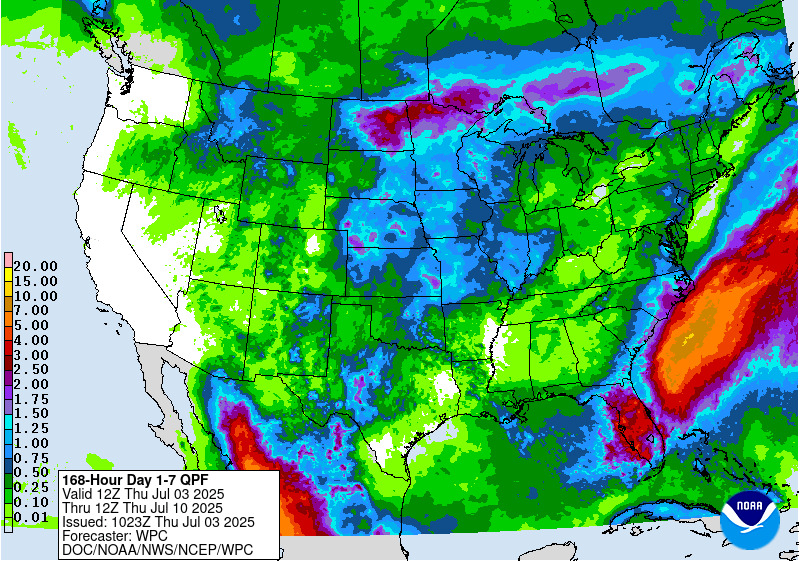
Figure 1. Total precipitation amounts forecasted for July 3-10, 2025.
Regarding drought, the U.S. Drought Monitor continues to classify northwestern Indiana as being in the Abnormally Dry (D0) category, with two isolated areas within that zone classified as Moderate Drought (D1) (Figure 2). There are two other areas in Indiana that we are monitoring for potential drought development: eastern Indiana, particularly around the Adams County area, and southern Indiana, along the Ohio River near the greater Louisville region. If the 7-day precipitation forecast verifies, then those two areas, along with northern Indiana, may degrade further regarding abnormal dryness and drought.
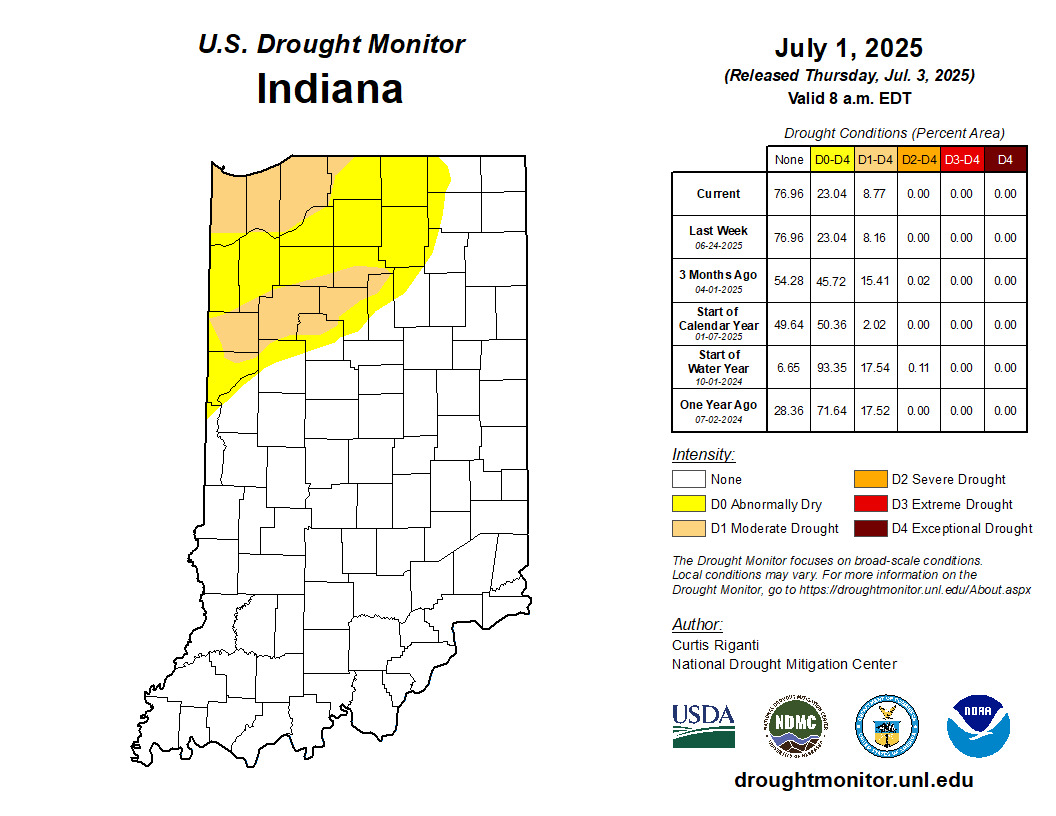
Figure 2. U.S. Drought Monitor status for conditions as of Tuesday, July 1, 2025.
The 3-7-day hazard risk report released by the National Weather Service indicates the risk for hazardous heat across most of Indiana this holiday weekend (Figure 3). Keep an eye on other people and animals around you, as heat distress often creeps up undetected until it’s too late. Be sure to hydrate often and seek shady environments when possible.
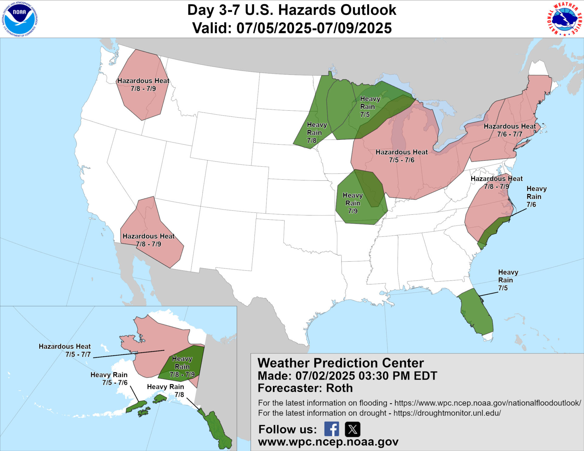
Figure 3. National maps indicating potential weather hazards for July 5-9, 2025.
The 6-to-14-day climate outlooks indicate that temperatures should be near normal, with a slight probability of warmer-than-normal conditions near the end of that period. Climate models slightly favor above-normal precipitation throughout the period. Climate outlooks for July (released on June 30) strongly favor above-normal temperatures for the month, with very little guidance on precipitation.