
Calling all corn and soybean producers and agricultural advisers! The United Soybean Board (USB), in partnership with the Midwestern Regional Climate Center (MRCC), Iowa State Extension, Iowa Department of Agriculture & Land Stewardship, and the Iowa Soybean Association, invites you to a virtual workshop informing the future of the MRCC’s Ag Climate Dashboard and new…Read more about July 16: Get Paid for Your Opinions About Ag Climate Data[Read More]
Climate and Weather
I couldn’t think of a better title this week, thanks to the hot weather we’ve been experiencing and the song by Arrow. While some people enjoy the heat and humidity, I must admit that I don’t find it overly pleasant. Over the past few days, average temperatures have ranged from 6 to 13°F above normal,…Read more about Feeling Hot, Hot, Hot[Read More]
We’ve made it! Meteorological summer started on June 1, but the official start of summer isn’t until June 20. The days are longer, temperatures have risen, and my allergies are in full swing. I let the dogs out last night, and there was still quite a bit of light in the sky just before 10:00…Read more about Meteorological Summer Has Arrived[Read More]
Welcome to the start of Hurricane Season, which runs from June through November each year. Why would Indiana care about hurricane season? Certainly, by the time any hurricane might impact the state, it will have been greatly downgraded to what is called an extratropical (i.e., poleward of the Tropic of Cancer (23.5° north latitude)) storm…Read more about It’s a Hazy Shade of …. June[Read More]
Precipitation in May has varied tremendously, but most of the state has generally been on the dry side. Areas from Vermillion and Parke Counties to Lake Michigan have received between 25% and 75% of the normal precipitation through May 27 (Figure 1). Conditions were dry enough that thunderstorm winds on May 16 prompted the National…Read more about Will May’s Mixed Precipitation and Temperatures Persist into June?[Read More]
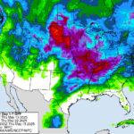
The last few weeks have been on the drier side, particularly for northwestern and west-central Indiana (Figure 1). While temperatures have been seasonal, they are still gradually increasing as we approach summer. Therefore, evapotranspiration rates are starting to increase. This has resulted in the U.S. Drought Monitor classifying much of northern Indiana as Abnormally Dry…Read more about A Bit of Rain Coming Our Way[Read More]
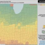
Midwestern farmers have faced a buildup of pesticide resistance in pigweeds (waterhemp and Palmer amaranth), highlighting the importance of scouting to detect weeds early in their growth stages. Otherwise, weed escapes are a common issue as herbicides lose their efficacy when weeds are allowed to grow long enough into their growth cycle. The Midwestern Regional…Read more about Midwestern Regional Climate Center Launches New Experimental Weed Emergence Scouting Tool[Read More]
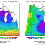
Despite the wet start to the month, the entire state saw less than 50 percent of normal rainfall from April 10 to 16, and in some cases, less than 10 percent of normal rainfall (Figure 1). This was helpful, especially since some locations are still dealing with river flood warnings and ponded, saturated fields. This…Read more about Wet Pattern to Return[Read More]
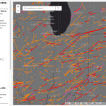
Indiana has already experienced several tornadoes this year, with more certainly to come. Of course, this is not unusual since Indiana is often considered on the far northeastern edge of “Tornado Alley”. Tornadoes get their energy from the battle between the cooler, drier Canadian air moving southeastward and the warmer, more humid air coming north…Read more about Tracking Tornadoes Over Time[Read More]
It happens every year. A warm wave moves into the area, and I immediately get the urge to run to the nursery and start planting for the spring. Of course, there is another little voice inside my head warning me not to fall for it. There are plenty of other things I can do outside…Read more about A False Sense of Spring?[Read More]